The boundaries of the District were first established in the Charter from the Florida legislature. Roughly situated in northeast Broward County, the district boundary is described as:
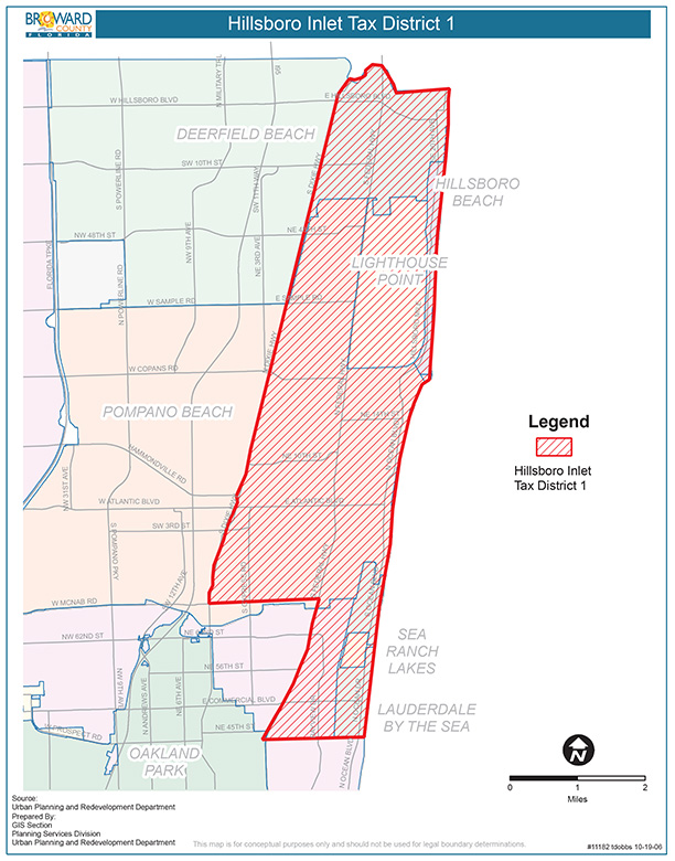
Beginning at the intersection of the Atlantic Ocean and the Broward County-Palm Beach County line; thence run Westerly along said Broward County-Palm Beach County line to West right-of-way line of Dixie Highway; thence South along the West right-of-way line of Dixie Highway to a point on the South line of Section 2, Township 49 South, Range 42 East; thence East along said South line of Section 2, Township 49 South, Range 42 East and Section 1, Township 49 South, Range 42 East to the east right-of-way line of Federal Highway U.S. #1; thence South along East right-of-way line of Federal Highway U.S. #1 to a point on the South boundary of Section 13 Township 49 South, Range 42 East; thence East along said South boundary of Section 13, Township 49 South, Range 42 East and Section 18, Township 49 South, Range 43 East, to the Atlantic Ocean; thence North along the mean low water mark of Atlantic Ocean to the Point of Beginning.